Our Services
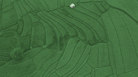
Almost any industry can benefit from aerial imaging. Photography and videography captured from a birds-eye vantage point gets the attention and visibility you want for everything imaginable – from marketing to site inspections to thermal energy detection. Aerial images can be further processed to offer additional insight, a game-changer in industries like agriculture. Why settle for uninspiring and ineffectual ground-level photography and video when aerial drone imaging is within your reach?
AERIAL TOPOGRAPHY SURVEYING
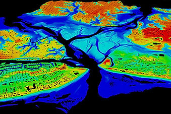
LiDAR (Light Detection and Ranging) is a remote sensing method used to detect objects in real space with a high level of precision and accuracy. In the UAV LiDAR process, a drone flies over a specified area sending out laser pulses onto a surface at a rate of 100k-3 million pulses per second. After measuring the time it takes for the signal to return, LiDAR Data is electronically compiled with GPS data and Inertial Measurement Unit (IMU) data to create a digital representation of the scanned area in a point file format used by professional surveyors to create a great number of deliverables for their clients.
LiDAR-equipped drones can reach ground surfaces through small openings in the canopy of foliage and plant life, capturing data difficult to collect by traditional methods – especially useful for industries such as agriculture, forestry, surveying, and land management / development.
LiDAR-equipped drones can fly at low altitudes and reach ground surfaces through heavy vegetation, enabling precise collection of locational data. This is especially valuable for archaeology, forestry, land development, and energy and utilities.
LiDAR data can be used by licensed professionals to create high-precision 3D models that deliver robust information not possible by traditional means, such as finding the low points on farmland for irrigation planning. Useful for many industries, including land management, agriculture, civil engineering, and construction.
In industries where regular equipment, structure, and site inspections are necessary for safety and regulatory compliance but accessibility and safety are concerns, drone inspections are an excellent alternative. With our team of experienced, licensed pilots, we can provide you with drone inspections that improve the safety of your worksite without sacrificing the attention to detail needed to keep equipment and structures properly maintained.
MACHINE-CONTROL MODELS
We don't simply convert 2D plans to 3D models, but rather coordinate the effort with contractors, surveyors and engineers to ensure the 3D model and drone data we deliver will maximize efficiency, productivity and profit for our customers in a cost effective manner. Our staff of engineers and technicians offer the required expertise and experience to help you get the most out of your investment in machine control, drones and the latest construction technology.
Machine Control Models are built using site plans, profiles, cross-sections, typicals and superelevation tables. We use this data to verify that the design is correct and to identify potential issues. 3D GPS Machine Control Modeling provides QA/QC which identifies potential problems at the start of construction. We build construction ready machine control models from approved engineered plans.


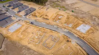
AERIAL AS-BUILT INSPECTIONS
Aerial inspections offer high-resolution photography and video footage that assist inspectors with their evaluations of a project by providing a detailed analysis from multiple perspectives. In turn, imagery and video footage is produced for reporting and presentations that assist clients and field personnel to interpret and understand issues, research foreseeable problem areas and address trending themes.
Use on demand aerial imagery for virtual construction site visits. Skip the surveying and view current and historical imagery to assess progress at your desk or on the go.